Osmand is opensource navigation application with raster/vector maps
OsmAnd+ Maps & Navigation
Osmand+ (OSM Automated Navigation Directions)
Osmand is opensource navigation application with access to a wide source of popular open street map data. All map data including vector and raster maps can be stored on the phone memory card for offline usage. Osmand also has online routing and audible guidance.
Osmand+ is a donation based application. By buying it you are supporting the project and receive latest updates via Android Market.
Some of the core features:
– new Wikipedia feature (download offline POIs)
– offline data, configurable folder for the maps and tiles
– compact vector maps for whole world
– offline search of addresses and places
– custom tile map area download
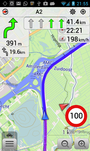
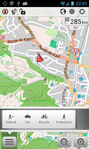
– pedestrian, bicycle and car modes
– many map layers with customized transparency at a time
– offline routing (experimental)
– Galaxy Tab supported
What’s in this version :
- New Wikipedia data structured by country and containing much more points than before
- Better routing recalculation (after several attempts engine suggests a different route)
- POI Search supports more specific queries (like fuel type and religion specific queries)
- Display turn arrows on route
- Orange color for POIs that are closed in 30 minutes from now
- Many fixes in different areas
- Additional favorites backup in case of application corruption or different issues
Requires Android:1.6 and up